Zooming in on Market Insights Why Do Postal Codes Matter?
One of the many choices businesses and organizations looking to analyze their market and gain customer insight need to make is choosing the geographic resolution of their statistical and demographic data. Any GIS analyst can tell you one geographic level of analysis may not be perfect for all questions, and there are many different options to choose from (CMA, CD, DA, FSA, Postal Code level, etc.).
However, many underestimate the value of postal code level data where significant differences in demographic variables and psychographics exist. Neighbourhoods are not created equal, and postal code level population data can capture significant differences between neighbourhoods that aggregated data like FSA (first 3 digits of postal code) cannot, in demographics and consumer behaviour.
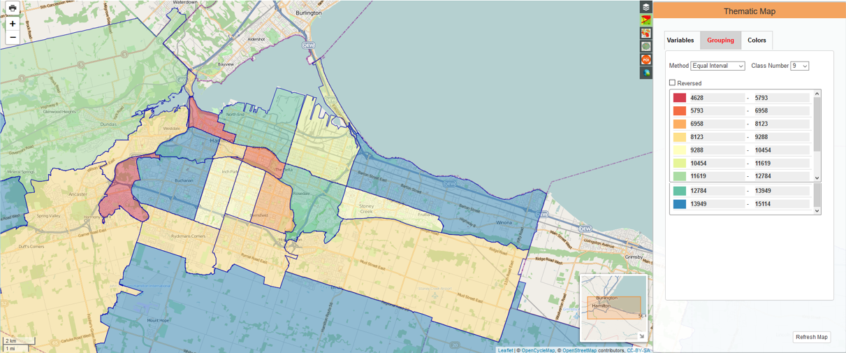
This thematic map at the FSA level of the number of dwellings with post secondary degrees in Hamilton shows that within the Hamilton core alone there is a wide range of neighbourhoods with varying levels of education.
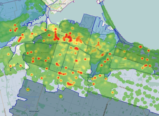
The overlying heat map indicates that even within the outlined Hamilton FSAs, there are smaller neighbourhoods that vary significantly in their concentration of individuals with post secondary degrees.
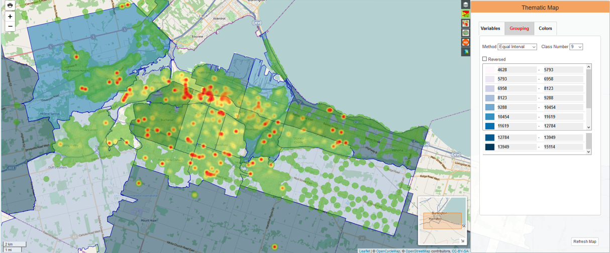
In particular, the concentration of individuals with post secondary degrees does not decline linearly as you leave McMaster University and Mohawk College. Somewhat surprisingly, some neighbourhoods like Fessenden, Gilbert, and Rolston that are farther from McMaster have higher concentrations of individuals with post secondary degrees than neighbourhoods that are closer like Buchanan, Westcliffe, and Mountview. Additionally, post secondary grads are far from being evenly distributed across the FSA. This has significant implications for businesses and organizations that analyze locations or use locations as inputs for their models, ranging from insurance to market research to targeted advertising to site selection for stores and retailers.
At Polaris, we understand the significance of geographic granularity, which is why our geo-demographic data has national coverage and is available at all standard postal and census geographies, including CMA, CD, DA, FSA, Postal Code level.